Navigation
- Search SE Lincoln Wx
- Home
- Mini-Home
- Quick Access Menu

- US Ridge II Radars
- GR3 Radar
- NWS Forecast
- NWS NE Point Forecasts
- Local NWS Forecast
- WXSIM Forecast
- GOES19-18 HAniS Loops
- GOES19 HAniS Loops
- GOES18 HAniS Loops
- Day 1-3 Fronts
- 3 Day Storm Risk
- QPF 3 Day Loops
- QPF 3 Day Snow/Ice Loops
- 3 Day Predicted Rainfall
- 3 Day Predicted Snowfall
- Winter Storm Severity
- 7 Day Forecast
- WFO Stories
- NWS WFO Text Products
- EHWO from CRH
- Excess Rain Potential
- Storm Prediction Center
- CPC Outlook
- Earthquake activity Last 7 Days
- Nearby METAR Station Reports
- SE Nebraska River Levels
- WPC River Flood Outlook
- Lightning Past 2 Hours
- Lincoln Live Traffic Cameras
- SE Lincoln Wx. Precip. Graphs
- US Drought Monitor
- On This Day
- World Extremes
- Radar
- Satellite Loops
- NOAA Radios
- Recent Weather
- Snowfall Maps
- Forecasts, Advisories, & Alerts
- NWS Forecasts
- WXSIM Forecast
- Forecast Models
- Snow Day Predictor
- Jet Stream Forecasts
- NWS WFO Text Products
- EHWO from CRH
- Resized NWS US Advisory Map
- NWS US Advisory Map
- NWS Advisories
- NWS Alerts
- Fire Danger
- UV Index Forecast
- NWS Forecasts
- NWS Weather Forecast Offices
- NWS Centers
- Weather Prediction Center
- Current Hi-Rez Surface Analyses
- Current 24 Hour Surface Analyses
- Current 24 Hour Analysis Loops
- Current 6 Hour Analysis Loop
- US Forecast Maps
- Day 1-3 Fronts
- ½ to 2½ Day Forecast Loop
- Day 3-7 Fronts
- Day 3-7 WPC Forecasts
- US 3 & 7 Day Front Loops
- Precipitation
- Excess Rain Potential
- Winter Storm Severity
- Winter 3 Day Lows
- Winter Weather Verification
- US 3-7 Day Loops
- US 3-7 Day Heat Indices
- NWS Experimental Heat Risk by State
- River Flood Outlook
- Current Hi-Rez Surface Analyses
- Storm Prediction Center
- 'Climate' Prediction Center
- Hurricane Center
- Meteorological Development Laboratory
- NSSL Op Product Viewer
- NWS Enhanced Data Display
- Environmental Lab
- NDFD Display
- Weather Prediction Center
- Wind & Forecast Charts
- River Levels
- Astronomy
- Almanac
- WebCam
- More Live Weather
- Lightning
- Travel & Road Conditions
- Station History
- Weather Underground WxHx
- Weather Trends
- Mesonets
- Area Mesomaps
- Drought Pages
- NASA Image of the Day
- World Extremes
- On This Day
- US Flu Maps
- Air Quality
- Pollen
- Links
- About
- Site Status
- Contact
- Website Map
- Mobile Pages

Alerts
Mobile Weather
Get SE LincolnWx SmartPhone Weather
 Scan With Phone's Bar Code Reader
US Weather Extremes
| ========== |
| USA |
| High Temp |
| 111°F at Desert Resorts Regional Ap, CA |
| Low Temp |
| 14°F at Fritzsche Aaf, CA |
| Precipitation |
| 4.51in at Cameron Municipal Airport, TX |
| ========== |
NE Weather Extremes
| ========== |
| NE |
| for
Tuesday, July 14, 2026 |
| High Temp |
| 99°F at Chadron Municipal Ap, NE |
| Low Temp |
| 58°F at Broken Bow Municipal Ap, NE |
| Precipitation |
| none |
| ========== |
| Data from NWS CPC |
External Links
Other Links
Local Sunlight Hours
14 hrs 48 min 35 sec
of Sunlight Today
Which is
1 min 22 sec Shorter
Than Yesterday
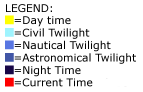
Legend
of Sunlight Today
Which is
1 min 22 sec Shorter
Than Yesterday
| (Noon) |

|
| (Midnight) |
Style Options

 
|
This website is neither affiliated with nor endorsed by the National Weather Service or any other government agency. The weather data contained herein is offered without any warranties express or implied, and is meant to only supplement, not replace, official NWS weather forecasts and information.