
Weather Alerts for Butler Co.Issued by the National Weather Service |
| No severe weather expected for Butler Co. |
Navigation
Alerts
Mobile Weather
Get SE LincolnWx SmartPhone Weather
 Scan With Phone's Bar Code Reader
US Weather Extremes
| ========== |
| USA |
| High Temp |
| 122°F at Auburn Municipal Ap, CA |
| Low Temp |
| 26°F at Chicago Aurora Municipal Ap, IL |
| Precipitation |
| 2.40in at Pensacola Regional Ap, FL |
| ========== |
NE Weather Extremes
| ========== |
| NE |
| for
Sunday, July 19, 2026 |
| High Temp |
| 105°F at Chadron Municipal Ap, NE |
| Low Temp |
| 59°F at Foxtrot (dix), NE |
| Precipitation |
| none |
| ========== |
| Data from NWS CPC |
External Links
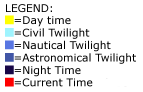
Local Sunlight Hours
| (Noon) |

|
| (Midnight) |
Style Options
Weather Alerts for Butler Co.Issued by the National Weather Service |
| No severe weather expected for Butler Co. |

 
|