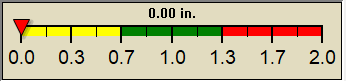
1 Rain season: Jan 1st to Dec 31st.
4Chandler Burning Index (CBI) Updates Continuously.
5 Estimated amount of water needed to replace the water used by plants and evaporation from the past week. (Negative numbers mean amount of water needed, positive numbers mean excess water is present).
6 Air Quality Index is provided by Douglas County Health Department in Omaha, NE. AQI Data for Lincoln, NE is currently unavailable as an RSS feed..
10 Historical average only to day 30 of just the month of May for this station since 2008.
11 Historical average rain this season to day 30 of May for this station since 2008.
NWS Weather Forecast -
Outlook Tonight & Sunday
Tonight
Chance Showers And TStorms then Showers And TStorms Likely
Lo 65°F
NWS forecast: A chance of showers and thunderstorms before 11pm, then showers and thunderstorms likely between 11pm and 1am, then a chance of showers and thunderstorms. Cloudy. Low around 65, with temperatures rising to around 68 overnight. Southeast wind around 12 mph, with gusts as high as 25 mph. Chance of precipitation is 60%. New rainfall amounts between a quarter and half of an inch possible. WXSIM forecast: Mostly cloudy to cloudy. Patchy light fog in the evening, then light to moderate fog after midnight. Rain likely. Thunderstorms very likely, some severe. Low 66°. Wind south-southeast around 10 mph, gusting to 18 mph, in the evening, becoming east-southeast after midnight. Chance of precipitation 70 percent. Precipitation mostly around half an inch.
Sunday
Chance Showers And TStorms
Hi 86°F
NWS forecast: A chance of showers and thunderstorms. Mostly cloudy, with a high near 86. Southeast wind 7 to 12 mph, with gusts as high as 21 mph. Chance of precipitation is 30%. New rainfall amounts between a tenth and quarter of an inch possible. WXSIM forecast: Mostly cloudy. Light to moderate fog in the morning, then patchy light fog in the afternoon. Rain likely in the morning, then a chance of rain in the afternoon. Thunderstorms very likely, some severe. High 78°. UV index up to 6. Wind south-southeast around 7 mph. Chance of precipitation 70 percent. Precipitation mostly between a quarter and half an inch.
NWS Short Term Weather Forecast
Sunday Night Slight Chance Showers And TStorms then Partly Cloudy
Monday
Mostly Sunny
Monday Night Partly Cloudy
Tuesday
Partly Sunny
Tuesday Night Partly Cloudy
Wednesday
Partly Sunny then Chance Showers And TStorms
Wednesday Night Chance Showers And TStorms
Lo 62°F
Hi 86°F
Lo 61°F
Hi 84°F
Lo 61°F
Hi 86°F
Lo 63°F
Season Countdown Timer by Curly
Precipitation average-to-date script courtesy of Murry Conarroe
ajax-dashboard.php - Version 1.32 - 18-Jan-2023 - Multilingual - Script by: Scott of BurnsvilleWeatherLIVE.com
Now supported by Saratoga-weather.org Download


 Scan With Phone's Bar Code Reader